All Places
Stories and photos added to the map, newest first.

Former town of Carl
Settled around 1856, the town was named after a child of Mr. and Mrs. Jephtah Robinson. http://iaadams.com/adamstwp.htm


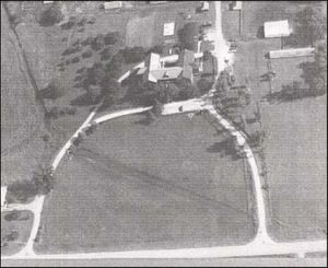
Story County Poor Farm and Knoll Cemetery
http://iastory.org/MilfordHist/browse.php?pagearg=51


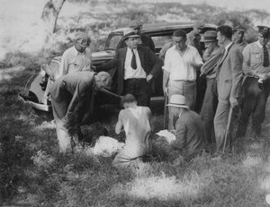
Bonnie and Clyde Shootout
Site of the July 24, 1933 shootout with Bonnie and Clyde, and others. https://www.dallascountyiowa.gov/about-the-county/history-of-dallas-county/bonnie-and-clyde-the-dallas-county-shoot-out

Dallas County Poor Farm
Former site of the Dallas County Poor Farm, now Dallas County human services facilities. http://www.theperrychief.com/living/poor-house-history.html https://theperrynews.com/former-county-poor-farm-officially-reopens-after-5-5-million-face-lift/

Interstate Planning?
Check the 1930 imagery vs today. It looks like someone drew the interstate on the 1930 maps?

Warren County Poor Farm
http://genealogytrails.com/iowa/warren/PoorFarm.htm
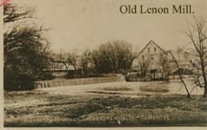
Lenon Mill
A woolen mill that was built in 1863, then switched to flour in 1877. Torn down in 1959.

Antle Cemetery
Earliest grave may be 1857.
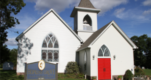
Hopkins Grove Church
Appears on the 1875 map and still exists today!
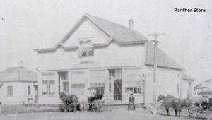
Panther
Former location of the Panther Store. There is a historical marker nearby.
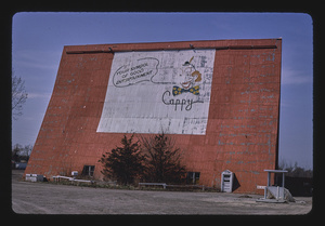
Capitol Drive-in Theater
This theater opened in 1952 and was demolished in the 1980s.

Former Canary Lake
Drained, possibly in the 1920s?

Drake Observatory
Built in 1921

Des Moines Golf and Country Club
Third site of the Des Moines Golf and Country Club, later Dowling High School. Built in the 1920s, visible on maps up to 1960. Moved due to I235 construction.